Forests accumulate massive volumes of biomass while sedimentary layers relentlessly stack upward. On a human scale, the planet can look as if it is adding matter to itself year after year. The best measurements we have indicate that the Earth is not growing at all and may even be losing a little mass each year.
Glossary of Key Terms
- Space Geodesy: The measurement of the Earth's geometric shape and gravity field using highly calibrated satellite tracking networks.
- Subduction: The geological process where a denser tectonic plate is forced downward beneath a lighter plate and recycled into the Earth's mantle.
- Pedogenesis: The biological and chemical process of soil formation from decaying organic material and weathered bedrock.
The Biological Illusion of Planetary Growth
The first step into the idea starts with something real. A tree does gain mass as it grows. A peat bog does get deeper. A dark, carbon-rich soil horizon can form where there was once bare mineral ground. Stay in one place long enough, and the surface can look as if it is rising under its own steam.
What is happening is transfer, not creation. Plants build most of their biomass from carbon dioxide in the air and water drawn from the ground. Through photosynthesis, carbon that was drifting around as an invisible gas ends up locked into roots, stems, leaves and wood. The mass becomes visible. That is where the intuition slips.
Soil pulls the same trick. Pedogenesis, the process of soil formation, starts with broken rock, water, microbes and decaying plant matter. Weathering turns bedrock into smaller mineral particles. Dead plants and microorganisms then add organic matter. That organic matter gives soil much of its bulk and dark colour. It can look as if the ground is manufacturing fresh material, but it’s not.
Global soils hold huge stores of organic carbon, larger than the carbon in living vegetation and larger than the carbon in the atmosphere. Read too quickly, and that can sound like a planetary stockpile built from nowhere. It’s nothing of the sort. Carbon has moved from one part of the Earth system to another. The atmosphere loses some. The soil gains it. The planet does not become heavier as a result of the exchange.
A forested hillside can look heavier than the same slope laid bare. A floodplain can sit higher after years of trapped silt. That can give the impression that the surface is steadily adding substance. It is usually movement, not growth. Rock breaks down further uphill, sediment is carried and dropped elsewhere, and carbon shifts from the air into living matter.
The Biological Carbon Phase-Change
Carbon exists as an invisible gas (CO₂) in the atmosphere.
Autotrophic organisms absorb CO₂ and water, transforming them into solid plant biomass.
Decomposition locks the carbon into the crust as dense soil organic carbon, creating the illusion of added mass.
The Astrophysical Mass Audit
Once the surface illusion falls away, the next question is asked. Does the Earth gain mass from space faster than it loses it? That is a fair test because the planet is not sealed off from the rest of the Solar System. Dust, rock and gas move in and out all the time.
The incoming side is real. Each year, the Earth sweeps up roughly 40,000 to 50,000 metric tonnes of cosmic dust and meteoritic material. Most of it is tiny. Much of it burns up in the atmosphere before it reaches the ground, as anything you could hold. It still counts. Space is dropping material on us all the time.
The outgoing side is larger. Light gases at the top of the atmosphere do not all stay put. Hydrogen escapes most readily because it is so light. Helium escapes, too, though in smaller quantities. Driven by thermal motion and interaction with solar radiation, the Earth loses about 95,000 tonnes of hydrogen and about 1,600 tonnes of helium each year.
That balance runs the wrong way for any expansion story built on mass gain. Even using the high end of the dust estimate, the planet still loses more light gas than it gains in incoming material. The Earth ends up with a net deficit of roughly 50,000 metric tonnes a year. Against the total mass of the planet, that is tiny, but the direction matters. It points away from expansion.
There is no astrophysical basis here for a growing globe. A body that loses more than it gains does not get larger.
Earth's Annual Mass Exchange
The Timeline Conflict of Plate Mechanics
The old expanding-Earth model survived for a reason. For a while, one piece of the evidence arrived before another. That gap gave the theory room to breathe.
By the early 1950s, geologists were mapping major mid-ocean features and realising that the seafloor was not flat and dead. Long ridges ran through the oceans. In places, those ridges contained central rift valleys that looked like zones where the crust was pulling apart. New seafloor seemed to be forming. That was a serious clue.
If new crust was forming at ridges, where was the old crust going? Without a firm answer, the geometry could push a researcher towards an expanding globe. If new ocean floor kept appearing and nothing was being destroyed, the surface area had to increase somehow. On that narrow point, expansion looked mathematically useful.
S. Warren Carey drove that case hard in the 1950s and after. He argued that a constant-radius Earth could not comfortably handle the opening of the oceans without demanding enormous, poorly evidenced zones of crustal destruction. He pointed to palaeomagnetic reconstructions and continental geometry and concluded that a smaller ancient Earth solved problems that plate tectonics had not yet solved cleanly.
Then the position weakened. Deep ocean trenches, earthquake belts and Wadati-Benioff zones, bands of seismic activity tracing slabs descending into the mantle, gave geology the missing answer about where old crust went. By the late 1960s, the system looked less like a balloon and more like a conveyor. New crust formed at ridges. Old crust went down in the trenches. The space left for expansion became much smaller.
The Tectonic Timeline Conflict
-
1952
Divergence Mapped
Mid-ocean rift valleys are identified via sonar, suggesting new crust is continuously forming.
-
1952 – Late 1960s
The Evidentiary Vacuum
Without a mapped recycling mechanism, the addition of new oceanic crust mathematically implies an expanding planet.
-
Late 1960s
Convergence Proven
Wadati-Benioff zones and deep oceanic trenches are confirmed as subduction zones, balancing crustal creation.
Internal Evidence Mishandling at Lamont
Geology was not the only thing slowing the argument. People slowed it too. Marie Tharp, working with trans-Atlantic sounding profiles in 1952, identified a continuous rift valley running along the Mid-Atlantic Ridge. A central rift offered a plausible physical setting for seafloor spreading.
Tharp later recalled that Bruce Heezen brushed off the finding as ‘girl talk’. Lamont’s later histories repeat that account. The phrase comes from retrospective sources, so it cannot be treated as a quote recorded at the time. What does hold is the sequence. Tharp identified the rift valley early. Acceptance did not follow straight away.
About eight months passed between the finding and Heezen’s acceptance of the interpretation. In that period, the ridge could be seen, but its significance was still being resisted. Earlier recognition would have strengthened the case for an active seafloor at a useful moment in the wider argument. The delay sits in the centre of that scientific dispute.
By 1956, Heezen and Maurice Ewing were publicly associated with the ridge discovery, while Tharp did not receive equal prominence in the main conference presentations. That points to evidence being slowed, filtered or fronted by the wrong people before the field caught up with its own data.
The Lamont Delay (1952–1953)
- Discovery: Marie Tharp mathematically identifies the mid-ocean rift valley.
- Dismissal: Bruce Heezen rejects the data as "girl talk" and ignores it for roughly eight months.
- Verification: Heezen eventually cross-references the rift with earthquake epicentres and accepts the finding.
- Impact: Institutional bias artificially delays the consensus on seafloor spreading, granting alternative geodynamic models an extended lifespan.
Data Siloing and Institutional Friction
Another brake sat above the scientists. During the Cold War, precise bathymetric data had military value. Detailed sonar measurements of the seafloor were useful for submarine navigation and underwater warfare, so the US Navy did not treat them as academic freebies.
That classification narrowed what could be argued in public. Scientists could work with highly informative sounding data, but they could not always publish the raw numerical contours in full. The wider scientific world often saw stylised physiographic diagrams instead. Those diagrams were revealing, but they were less transparent than the measurements underneath them.
It made a practical difference. A sonar log gives you numbers, and a stylised sketch gives you a shaped picture. When the numbers are not fully open, the dispute gets more room to run. Expansionists could point at the ridges and say the oceans were opening, while the evidence for recycling old crust was harder to inspect directly. The shared evidential ground was weaker than it looked.
This is a plain case of data siloing. Nobody needs a grand plot for it to have consequences. One institution held crucial information. Another had to work around the restrictions. The argument then unfolded with part of the table still covered.
Cold War Data Siloing
How military classification shaped the geological debate.
US Navy Archives
Highly precise numerical contour data detailing exact depths and seafloor topography.
Classified as 'Secret' or 'Confidential' to protect submarine warfare navigation.
Public Scientific Sphere
Stylised 3D sketches created by researchers to circumvent classification rules.
Visually striking but lacked the hard topographical data needed to decisively prove subduction mechanics.
The Actor-Led Dissent of Modern Expansion Tectonics
The modern version of the theory is tied most clearly to Dr James Maxlow, an Australian geologist who argues for what he calls ‘Expansion Tectonics’. His case is not just historical nostalgia. He claims conventional plate models rely on circular reasoning because they assume a constant-radius Earth from the start.
Maxlow also rejects subduction as a real balancing mechanism. In his account, symmetrical magnetic striping on either side of mid-ocean ridges shows that ocean basins grew as the Earth expanded. He has built a sequence of 24 scale models to reconstruct that supposed growth and argues that the current rate of radial increase is about 22 millimetres per year.
That figure is the problem. A claim like 22 millimetres per year is testable against direct measurement. If it were right, it would show up in the geodetic record very quickly.
The same problem hits the rejection of subduction. Modern seismology and mantle imaging leave little room for a simple line that subduction does not exist. The models of Expansion Tectonics may be coherent on their own terms, but they do not account for the geodetic and seismic record that now exists.
Expansion Tectonics
Dr. James Maxlow's 24 Scale Models
The Method
Removing modern oceanic magnetic striping and bringing continental edges together backwards through geologic time.
The Assumption
Rejects subduction entirely. All mid-ocean ridge growth is treated as net planetary expansion.
The Conclusion
A claimed exponential growth curve, peaking at a current inflation rate of 22 mm/year.
Geodetic Falsification and the ITRF Record
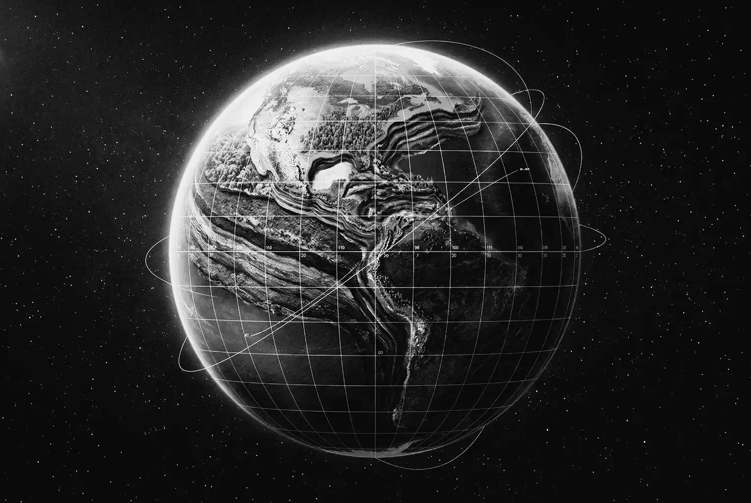
This is where the modern case runs out of road. The International Terrestrial Reference Frame ( ITRF) is the global system used to measure the Earth’s shape, orientation and motion with extreme precision. It does not care whether an old geological argument was elegant. It measures the planet.
ITRF is built from several separate measuring methods. Very Long Baseline Interferometry uses radio telescopes and quasars to pin down scale and position. Satellite Laser Ranging times laser pulses reflected back from satellites. GNSS networks follow ground positions through navigation satellites. DORIS provides another radio tracking system. The value of the setup is simple. The Earth is being measured in more than one way at once.
In 2011, NASA researchers used these geodetic systems to test the expansion claim directly. Their result for the mean change in Earth’s radius was about 0.1 millimetres per year, a figure so small that it is statistically indistinguishable from zero. Result, the solid Earth was not expanding in any measurable way.
Later updates did not rescue the larger claim. ITRF2020 and its later update processed decades of VLBI, SLR, GNSS and DORIS observations and found no drift consistent with a globe expanding by 22 millimetres a year. A change that large would not hide in the noise. It would interfere with the same satellite and positioning systems used every day.
That is where the modern expansion claim stops as a physical proposition. The old idea still has visual appeal. The space-geodesy record does not support it. If the Earth were expanding by 22 millimetres a year, the satellites would know.
The Geodetic Falsification
| Metric | Expansion Tectonics Claim | ITRF Geodetic Reality |
|---|---|---|
| Annual Radius Change | 22.0 mm / year | ~0.1 mm / year |
| Subduction Mechanics | Claimed non-existent | Verified via seismic tomography |
| Measurement Basis | Topological reverse-modelling | SLR, VLBI, GNSS, and GRACE data |
Sources
Sources include: Department of Energy records on the global carbon cycle; ‘Decadal and annual variations in meteoric flux from Ulysses, Wind, and SOFIE observations’ alongside studies on the atmospheric escape of terrestrial planets; NASA Jet Propulsion Laboratory’s 2011 geodetic analysis utilising the International Terrestrial Reference Frame; historical records encompassing the 1956 Hobart Symposium Proceedings and S. Warren Carey’s foundational papers; the Library of Congress finding aid for the Heezen-Tharp collection detailing classified US Navy bathymetric data; Lamont Geological Observatory internal histories, including Marie Tharp’s 1999 retrospective essay; and Dr James Maxlow’s modern publications regarding Expansion Tectonics.
Investigation Claim-Source Matrix
| Core Claim | Underlying Source | Status |
|---|---|---|
| The biological carbon pump fixes atmospheric carbon dioxide into solid plant biomass and soil organic carbon, creating no net planetary mass addition. | Department of Energy, The Carbon Cycle | Confirmed |
| The Earth accretes approximately 40,000 to 50,000 metric tonnes of cosmic dust and meteoritic material annually. | Decadal and annual variations in meteoric flux | Confirmed |
| The Earth loses approximately 95,000 tonnes of hydrogen and 1,600 tonnes of helium to atmospheric escape each year. | Atmospheric Escape and Evolution of Terrestrial Planets | Confirmed |
| Geodetic systems confirm the Earth's mean radius change is 0.1 millimetres per year, indistinguishable from zero. | NASA Jet Propulsion Laboratory (2011) | Confirmed |
| Bruce Heezen initially dismissed Marie Tharp's 1952 discovery of the mid-ocean rift valley. | Lamont internal history; Tharp retrospective essay (1999) | Confirmed |
| US Navy Cold War security classifications restricted raw bathymetric contour data. | Library of Congress, Heezen-Tharp collection finding aid | Confirmed |
| The Earth is currently expanding at a rate of 22 millimetres per year, and oceanic subduction does not exist. | Dr. James Maxlow, Expansion Tectonics publications | Contradicted |
| S. Warren Carey's 1954 papers on continental drift via expansion were rejected by reviewers as 'fanciful'. | Australian Academy of Science Biographical Memoirs | Confirmed |
What we still do not know
- The exact internal routing slips from the Geological Society of Australia regarding S.W. Carey's 1954 manuscript submissions.
- Whether early peer-review rejections of Carey's work cited specific mathematical errors or relied entirely on institutional dogma.
- The full unredacted numerical datasets from early US Navy military sonar deployments.
- The precise volumetric data comparing the exact cubic kilometres of crust created at ridges versus crust consumed at trenches over deep geological time.
Comments (0)