
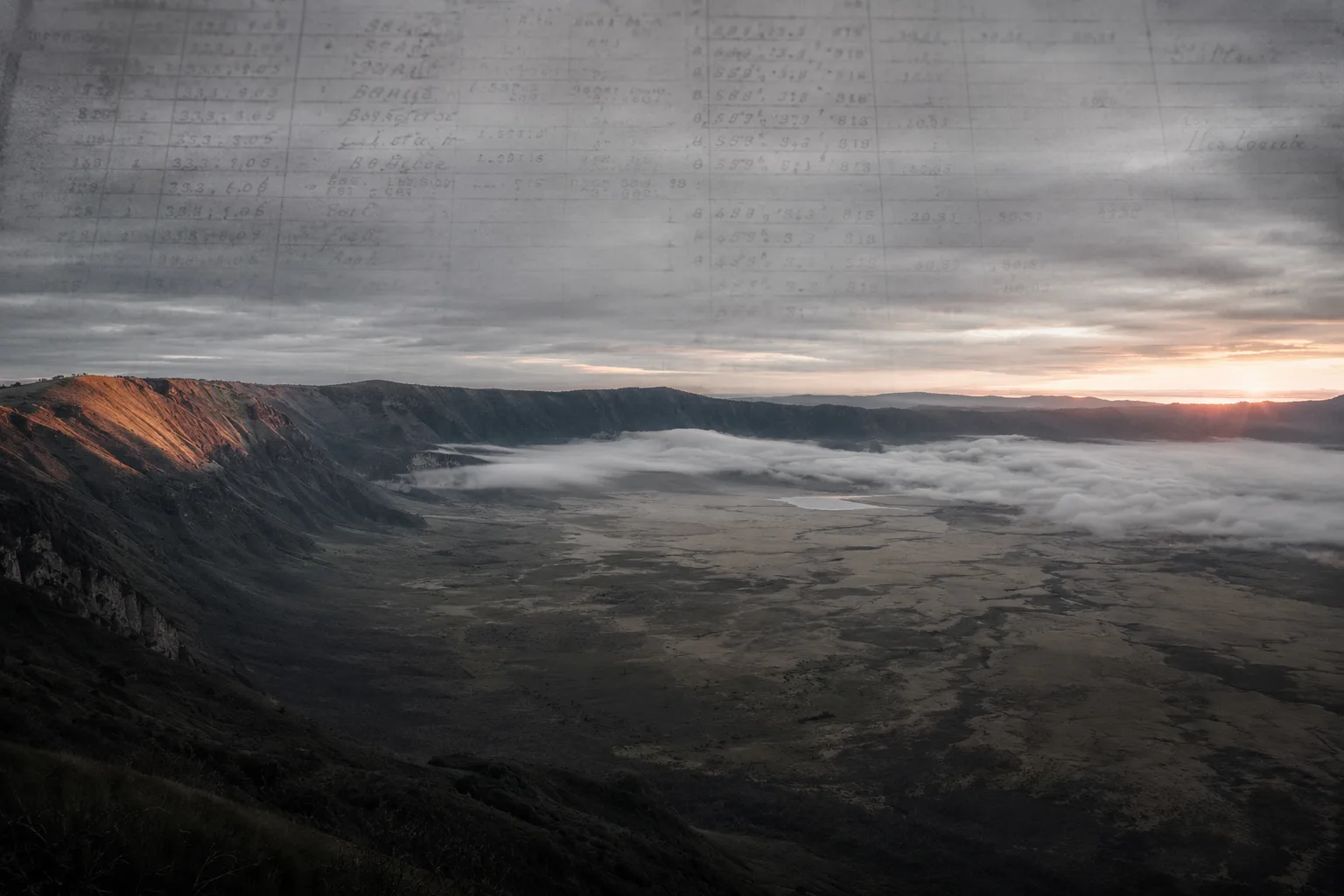
On 12 March 2026, the Ndika Presidential Commission handed President Samia Suluhu Hassan a report naming three species as locally extinct in the Ngorongoro Crater: Oryx, Eland and Gerenuk. The same three animals appear, in the same order, on pages 65, 68, 69 and 85 of a Tanzanian Ministry review printed seven years earlier. No independent field survey has been conducted to reconcile these two lists.
Data Manifest
- Primary Investigation: The Ngorongoro Conservation Area exclusion policies, and the reuse of 2019 Ministry ecological and demographic figures inside the 2026 Ndika presidential commission report submitted to President Samia Suluhu Hassan on 12 March 2026.
- Key Anomalies Documented: A 3.6 per cent annual human population growth rate carried from the 2019 Ministry review into the 2026 Ndika report, against a 1.6 per cent rate derived from the 2022 National Bureau of Statistics census; the same three locally extinct species (Oryx, Eland, Gerenuk) listed in the same order in both reports without independent field verification; Dr Maurus Msuha serving as secretary to both commissions; and a 2017 livestock count of 228,955 Tropical Livestock Units sitting below the 1994 optimal of 250,925 Large Herbivore Units, with the dry-season limit exceeded by only 366 units.
- Primary Sources Utilised: Multiple Land Use Model Review Report, Ministry of Natural Resources and Tourism (October 2019); PLOS One (Moehlman et al., 2020); Journal of African History (Hodgson, 2000); Oryx (Fosbrooke, 1965); Oakland Institute reports (2021, 2022); BBC Radio (5 September 1958); The Chanzo (26 March 2026); and National Bureau of Statistics census returns (2017 and 2022).
Glossary
- Pastoralism: A way of life in which people move their livestock across land to find seasonal grazing and water, rather than farming in one fixed place.
- Multiple land use area: A legal designation that lets more than one activity share the same land, such as wildlife conservation and human settlement, rather than picking only one.
- Large Herbivore Unit (LHU): A standard measure used to count both wild and domestic plant-eating animals together, so total grazing pressure on the land can be added up.
- Tropical Livestock Unit (TLU): A standard measure used to compare different types of farm animals on the same scale, by counting each animal as a fraction or multiple of one adult cow.
- Carrying capacity: The largest number of animals the land can feed and water without lasting damage to soil or vegetation.
- Presidential commission: A temporary investigation body set up directly by a country's president to examine a specific issue and produce a report with recommendations.
The 1951 Colonial Baseline
In 1948, a British colonial census in Tanganyika counted 47,000 Maasai across 23,000 square miles of grazing country. The count also logged 650,000 cattle and 500,000 sheep and goats. In the same set of files, administrators noted that 70 per cent of the land could not be used in the dry season because of missing water and tsetse fly infestation.
That admission was critical; it attributed the strain on herds to the land’s limitations rather than animal density.
Three years later, the colonial administration launched the Masai Development Plan. Its stated aim was to alter the stock-carrying capacity of Maasailand and press the semi-nomadic Maasai into bounded ranching areas. Historian Dorothy Hodgson, working through the same set of declassified colonial files in the Journal of African History, traces the plan back to the internal admission that the land, not the herd, was the problem.
In 1959, an ordinance separated the crater and highlands from Serengeti National Park under a new name: the Ngorongoro Conservation Area. That statute set up a multiple land use area, which carried a legal duty to safeguard the interests of the Maasai residents living inside it. A multiple land use area is a legal designation that lets more than one activity, such as wildlife conservation and human settlement, share the same territory.
That legal duty is still on the books. And the assumption behind the 1951 plan is still operating.
1948 Colonial Files against the 1951 Policy Aim
- 1948 Tanganyika census: 47,000 Maasai across 23,000 square miles of grazing country; 650,000 cattle; 500,000 sheep and goats.
- 1948 administrative note: 70 per cent of the land could not be used in the dry season because of missing water and tsetse fly infestation. The strain was located in the land itself.
- 1951 Masai Development Plan aim: Alter the stock-carrying capacity of Maasailand and press the semi-nomadic Maasai into bounded ranching areas.
- Chain observed: The stated policy aim in 1951 relocated the problem from land quality to stocking pressure, three years after the colonial files had already pinned it on drought and tsetse.
Governor Twining Policy Admission
On 5 September 1958, British colonial Governor Edward Twining gave a BBC radio interview about the Maasai. He said the group did not threaten wildlife, that the land rightfully belonged to them and that the population figures being cited to pressure them out were exaggerated propaganda.
Twining was the senior administrator responsible for the very policy he was describing. The statement went out over the airwaves and was preserved in the BBC’s audio record.
Despite this admission, the Masai Development Plan proceeded without modification, driven by an administrative habit of blaming pastoralist stocking for issues already linked to environmental factors.
Priority Briefings
New investigations, evidence checks, and unresolved questions from Veriarch, sent directly to your inbox.
Ecological Monitoring and Population Data
Long-term ecological monitoring inside the Ngorongoro Crater covers the years 1963 to 2012. Peer-reviewed work by Moehlman and colleagues, published in PLOS One in 2020, tracked the combined weight of wild plant-eating animals across those five decades. That weight remained broadly stable.
The same paper identifies a persistent 4.83-year rainfall cycle as the primary driver of population swings among the wild herbivores. Rain, not grazing pressure, is doing the pushing.
Historical records back the same reading. In 1961 and 1962, exceptionally heavy rains produced a plague of biting flies, Stomoxys calcitrans, inside the crater. Conservator Henry Fosbrooke, then head of the Ngorongoro Conservation Area, logged the event in his own files.
The plague decimated the local lion population.
That same pattern showed up in the drought of 2000 to 2001. Buffalo and wildebeest died in large numbers, independent of any human grazing pressure. In the PLOS One data set, the episode is logged as disease-and-drought driven.
Meanwhile, the government’s own numbers point the same way. In 1994, the optimal stocking level for the conservation area was formally calculated at 250,925 Large Herbivore Units. A Large Herbivore Unit is a standard measure that counts different plant-eating animals, wild or domestic, on one shared scale.
In 2017, the district veterinary officer recorded 238,826 cattle, 226,260 goats, 344,373 sheep and 22,104 donkeys. Converted through the government’s own formula in the October 2019 review, that stock came to 228,955 Tropical Livestock Units, a closely related unit based on one adult cow. The figure sits below the 1994 optimal.
The 2019 report went further still. It admitted that the dry season limit was exceeded by only 366 units. That is the government’s own number, in the government’s own file, contradicting the government’s own conclusion.
Stocking Levels: The Government's Own Numbers
Two figures the ministry set. One count it took. One margin it admitted.
1994 Optimal Stocking Capacity
Large Herbivore Units. The state's own benchmark for the conservation area.
2017 Recorded Livestock Count
Tropical Livestock Units converted from the district veterinary officer's 2017 count of 238,826 cattle, 226,260 goats, 344,373 sheep and 22,104 donkeys. Sits below the 1994 optimal.
2019 Dry-Season Admission
Units by which the dry-season limit was exceeded, according to the October 2019 Multiple Land Use Model review. The government's own file records the margin.
The Ministry's Own File Against Its Own Conclusion
The 2017 count sits below the 1994 optimal, and the 2019 report puts the dry-season overshoot at 366 units. Neither figure supports the state's claim of large-scale overstocking.
2019 Ministry Report and UNESCO Review
The 2019 Ministry file did not stop at the 366-unit number. Its October 2019 Multiple Land Use Model review report went on to recommend drastic spatial zoning and the relocation of tens of thousands of residents. A US-based policy group, the Oakland Institute, later reproduced the document in full.
Which brings us to March 2019, six months earlier.
That month, a joint monitoring mission from the UNESCO World Heritage Centre, the IUCN and ICOMOS visited the site. Its report urged the Tanzanian government to take urgent action on human population growth in the conservation area. According to that report, the international advisory bodies were working from ecological data supplied by the state.
Briefing files that Tanzania handed to those inspectors have not surfaced in any archive consulted for this investigation. Nobody outside the mission and the ministry has seen the raw dataset.
In April 2021, the government announced the resettlement plan itself. Officials targeted 82,000 residents for relocation to Msomera village and described the movement as voluntary.
A 2026 report by the Iyombe presidential commission, together with monitoring by the Oakland Institute, later logged something else. From 2022, education and healthcare budgets inside the conservation area were being reduced. Community records tracked the transfer of TSHS 355.5 million in education and health funds out of the area, redirected to Handeni District, where Msomera sits.
The Data Trail: March 2019 to April 2021
Joint monitoring mission from the UNESCO World Heritage Centre, the IUCN and ICOMOS visits the Ngorongoro Conservation Area. Mission report urges urgent action on human population growth, working from ecological data supplied by the Tanzanian state. The underlying briefing files have not surfaced in any archive consulted for this investigation.
Multiple Land Use Model review report published by the Ministry of Natural Resources and Tourism. Recommends drastic spatial zoning and the relocation of tens of thousands of residents. Contains the 2017 livestock count of 228,955 Tropical Livestock Units and the 366-unit dry-season admission.
Tanzanian government announces resettlement to Msomera village, targeting 82,000 residents. Officials describe the movement as voluntary.
Community records log the transfer of TSHS 355.5 million in education and health funds out of the conservation area to Handeni District, where Msomera sits. Reported reduction in in-area services runs alongside the resettlement policy.
Conflict of Interest in Commission Reports
Somewhere between the 2019 file and the 2026 report, the same name appears twice.
Dr Maurus Msuha served as secretary to the 2019 Multiple Land Use Model review commission. When President Samia Suluhu Hassan appointed the 2026 Ndika presidential commission to audit the same set of findings, Dr Msuha was named its secretary as well. The team roster is preserved in a Maasai community report and confirmed by lawyer Joseph Oleshangay in an interview with the Tanzanian outlet The Chanzo on 26 March 2026.
Oleshangay, a Maasai lawyer active in the eviction cases, argued in that same interview that the arrangement placed one official in charge of auditing files he had helped write. His view is on the record with The Chanzo.
No conflict-of-interest declaration by Dr Msuha at the time of the 2026 appointment has been found in any personnel file consulted for this investigation.
One Secretary, Two Commissions
The same official held the secretariat on both files. The 2026 commission audited data he had helped assemble in 2019.
2019: Author's Chair
Secretary to the Multiple Land Use Model review commission, Ministry of Natural Resources and Tourism.
October 2019 MLUM review report, containing the 3.6 per cent population growth figure, the 2017 livestock count and the 366-unit dry-season admission. Later reproduced in full by the Oakland Institute.
2026: Auditor's Chair
Secretary to the Ndika presidential commission appointed by President Samia Suluhu Hassan.
Ndika report submitted 12 March 2026. Carries forward the 3.6 per cent growth rate and the same three-species extinction list, without independent field surveys.
No conflict-of-interest declaration by Dr Msuha for the 2026 appointment has been produced in any personnel file consulted for this investigation.
Ndika Commission Data Verification
The Ndika and Iyombe presidential commissions handed their reports to President Samia Suluhu Hassan on 12 March 2026. Ndika’s was the report dealing with land use.
Its headline number for human population growth was 3.6 per cent per year. That same figure had appeared in the 2019 Ministry review. Joseph Oleshangay, in his 26 March interview with The Chanzo, argued that the number had been copied across without adjustment.
Meanwhile, the National Bureau of Statistics had already produced a different figure. Its 2022 census recorded 117,930 residents inside the conservation area. Set against the 93,136 residents counted in 2017, that comes out at 1.6 per cent annual growth.
The Ndika commission relied solely on this outdated figure.
The extinction list followed the same route. Ndika’s 2026 report named three species as locally extinct in the crater: Oryx, Eland and Gerenuk. Oleshangay’s interview points to pages 65, 68, 69 and 85 of the 2019 Ministry report, where the same three species appear in the same order.
No independent field survey by the Ndika commission sits between the two lists. Soil sampling, vegetation surveys, fresh species counts: none has been produced by the commission to back the claim as its own finding.
Local pastoral councils and legal advocates argue that these reports were engineered to justify land clearance to generate tourism revenue. While this investigation has not uncovered explicit internal directives confirming deliberate falsification, we see a clear pattern: outdated data was recycled, the 2022 census was disregarded, and the commission’s oversight was consolidated under the same official.
The 2019 report’s list of extinct species was not verified against the crater floor. Neither was the 2026 report’s. And the ward-level 2022 census returns that would allow an independent recount of the 1.6 per cent figure remain sealed.
2019 Ministry, 2026 Ndika, 2022 Census: Side by Side
| 2019 Ministry Report | 2026 Ndika Report | 2022 NBS Census Reality |
|---|---|---|
| Human population growth rate stated at 3.6 per cent per year. | Human population growth rate carried across at 3.6 per cent per year. | 117,930 residents in 2022, against 93,136 in 2017. Actual annual growth rate of 1.6 per cent. |
| Locally extinct species listed as Oryx, Eland and Gerenuk, on pages 65, 68, 69 and 85. | Same three species listed as locally extinct, in the same order, in the report submitted 12 March 2026. | Census does not address species status. No independent field survey has been produced to sit between the two lists. |
| Underlying field notes, soil sampling and vegetation surveys have not been produced by the Ministry of Natural Resources and Tourism. | No independent soil sampling, vegetation survey or fresh species count produced by the commission to back the claim as its own finding. | Ward-level 2022 census returns remain sealed, preventing independent recalculation of the 1.6 per cent figure. |
Support the Archive
Help fund the retrieval, hosting, and preservation of Veriarch investigations.
Source Box
Sources include: colonial administrative material described in Dorothy Hodgson’s ‘Taking Stock: State Control, Ethnic Identity and Pastoralist Development in Tanganyika, 1948–1958’, Journal of African History, Volume 41, Number 1 (2000); the BBC Radio interview with Governor Edward Twining (5 September 1958); peer-reviewed ecological data from Moehlman and colleagues, ‘Long-term historical and projected herbivore population dynamics in Ngorongoro crater, Tanzania’, PLOS One, Volume 15, Number 3 (2020); Henry Fosbrooke’s ‘Success Story at Ngorongoro’, Oryx, Volume 8, Number 3 (1965); Bruce Byers’s Oxford presentation ‘Population Growth, Environmental Degradation, and Conflict in the Ngorongoro Conservation Area, Tanzania’ (1994); the Multiple Land Use Model Review Report, Ministry of Natural Resources and Tourism, United Republic of Tanzania (October 2019); the IUCN World Heritage Outlook Report on Ngorongoro Conservation Area (2019); the Oakland Institute reports ‘The Looming Threat of Eviction: The Continued Displacement of the Maasai Under the Guise of Conservation in Ngorongoro Conservation Area’ by Anuradha Mittal and Elizabeth Fraser (2021) and ‘The Truth, Falsity and Mismanagement’ community report (2022); the National Bureau of Statistics census figures for the Ngorongoro Conservation Area (2017 and 2022); the interview with lawyer Joseph Oleshangay in ‘The Chanzo’ (26 March 2026); and the Human Rights Watch report ”It’s Like Killing Culture’: Human Rights Impacts of Relocating Tanzania’s Maasai’ (2024).
Claim-Source Matrix
| Core Finding | Primary Source Document | Status |
|---|---|---|
| 1948 British colonial census in Tanganyika counted 47,000 Maasai, 650,000 cattle and 500,000 sheep and goats across 23,000 square miles; administrators noted 70 per cent of the land unusable in the dry season. | Hodgson, 'Taking Stock: State Control, Ethnic Identity and Pastoralist Development in Tanganyika, 1948–1958', Journal of African History (2000). | Confirmed |
| 1959 Ngorongoro Conservation Area Ordinance created a multiple land use area with a statutory duty to safeguard the interests of Maasai residents. | Indigenous Rights and Protected Areas Database; Oakland Institute community report (2022). | Confirmed |
| Wild herbivore biomass inside the Ngorongoro Crater remained broadly stable from 1963 to 2012; a persistent 4.83-year rainfall cycle is the primary driver of population swings. | Moehlman et al., 'Long-term historical and projected herbivore population dynamics in Ngorongoro crater, Tanzania', PLOS One (2020). | Confirmed |
| 1961–62 plague of Stomoxys calcitrans decimated the local lion population, driven by exceptionally heavy rains rather than pastoralist activity. | Fosbrooke, 'Success Story at Ngorongoro', Oryx (1965). | Confirmed |
| October 2019 Multiple Land Use Model review report recommended drastic zoning and relocation, despite the 2017 livestock count of 228,955 Tropical Livestock Units sitting below the 1994 optimal of 250,925 Large Herbivore Units and the dry-season limit exceeded by only 366 units. | Multiple Land Use Model Review Report, Ministry of Natural Resources and Tourism (October 2019); reproduced in Oakland Institute report by Currier and Mittal (2021). | Confirmed |
| April 2021 government announcement of resettlement to Msomera village targeting 82,000 residents, described by officials as voluntary. | Oakland Institute report by Currier and Mittal (2021); Oakland Institute community report (2022). | Confirmed |
| From 2022, education and healthcare budgets inside the conservation area were reduced; community records track the transfer of TSHS 355.5 million out of the area to Handeni District. | Oakland Institute community report (2022); District Executive Director letters. | Confirmed |
| Dr Maurus Msuha served as secretary to both the 2019 Multiple Land Use Model review commission and the 2026 Ndika presidential commission; no conflict-of-interest declaration for the 2026 appointment has been produced. | 'The Chanzo' interview with Joseph Oleshangay (26 March 2026); Oakland Institute community report (2022). | Confirmed (attributed critique by Joseph Oleshangay) |
| 2026 Ndika presidential commission report carried a 3.6 per cent annual human population growth rate, against the 1.6 per cent rate derived from the 2022 National Bureau of Statistics census (117,930 residents in 2022 against 93,136 in 2017), and listed the same three locally extinct species (Oryx, Eland, Gerenuk) as the 2019 Ministry report, in the same order. | 'The Chanzo' interview with Joseph Oleshangay (26 March 2026); Multiple Land Use Model Review Report, Ministry of Natural Resources and Tourism (October 2019). | Confirmed (attributed critique by Joseph Oleshangay) |
What We Still Do Not Know
- The raw ecological datasets the Tanzanian government submitted to the UNESCO, IUCN and ICOMOS joint monitoring mission in March 2019 remain outside the public record.
- Whether Dr Maurus Msuha filed any formal declaration of conflict of interest on his appointment to the 2026 Ndika commission is not shown in any personnel file consulted for this investigation.
- Ward-level returns from the 2022 National Bureau of Statistics census remain sealed, preventing independent recalculation of the 1.6 per cent growth rate.
- Field notes underlying the 2019 Multiple Land Use Model review, including any primary soil or vegetation sampling, have not been produced by the Ministry of Natural Resources and Tourism.
- The 1957 Serengeti Committee of Inquiry working papers, needed to test whether the 1994 and 2019 stocking models share a common colonial equation, have not surfaced in any archive consulted.
- How the specific figure of 82,000 residents targeted for relocation to Msomera village was calculated, and against which household register, is not disclosed in the April 2021 announcement.
Comments (0)